Earthbound Artist

Articles tagged as Travel Stories (view all)

Our Baffin Island Snowmobile Adventure

19 April, 2017 10 comments Leave a comment

Richardson party in Iqualuit on Baffin Island

To celebrate our 40th wedding anniversary, John and I, with friends Rick and Nancy, embarked on a 3-day guided snowmobile adventure on Baffin Island, in Canada's far north. Our trip was on Easter weekend, to take advantage of the long hours of daylight and milder spring temperatures.

Iqualuit Baffin Island

We flew via First Air on a Friday morning, from Ottawa to Iqualuit, the capital of the territory of Nunavut. After a 3-hour flight, this was our first view of the town from our airplane. We stayed at the big brown building at the top of the photo above.

John and Karen Richardson in Iqualuit Baffin Island

Our guide from Arctic Kingdom picked us up at the airport, and we collected our snowmobiles. John and I are pictured above on our Arctic Kingdom Polar Expedition Grand Touring Skidoo.

Richardson party on Baffin Island

We all went on a short test ride on the sea ice. The photo above shows John and I beside our Skidoo, with our friends in the background. Rick and Nancy each drove a Skidoo.

Sled dogs and Fuel tanks Baffin Island

We saw lots of dogsled teams tied up near the shore. In the background are fuel storage tanks, that are refilled every summer from tanker ships, to provide fuel for the town of Iqualuit all year.

Frobisher Bay, Baffin Island

After an excellent dinner and comfortable overnight stay at the Frobisher Inn, we set off early Saturday morning across the sea ice of Frobisher Bay (shown above). This 20 km crossing took us over tortuous 2-meter pressure ridges near Iqualuit, then over smoother sea ice to the far shore of the Bay. 

Baffin Island trip equipment

Our destination was the tiny village of Kimmirut on the other side of a large peninsula on Baffin Island, about 130 km away. The photo above shows the two traditional qamutik (pronounced KAMmatick) expedition sleds made of wood and twine, and five snowmobiles, that made the journey. We had to bring all our gas, personal luggage, safety equipment, camp stove, and food with us.

Baffin Island snowmobile trail

We followed tundra trails through more than 100 km of Katannilik Territorial Park, and along the Soper River valley. We enjoyed sunshine and blue sky all day, surrounded by glaciated mountains and pure white snow. The trail was busier than we had expected, and we saw about 50 snowmobiles that day, because there was a snowmobile race along the route we were taking.

 Baffin Island trail hut

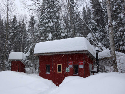
Shelter cabins, like the one pictured above, were provided at intervals along the route to Kimmirut. Travelers use them to get out of the wind for a lunch break or even to sleep in overnight. The huts are very plain, with one window, one door, a chimney vent, and three raised platforms inside. Visitors have to provide their own heat source, such as a camp stove.

Baffin Island guide making tea

The photo above shows the inside of the cabin where we stopped for lunch. This is Wayne Broomfield, our unflappable, capable guide, boiling water and heating soup on a camp stove. We enjoyed homemade vegetable beef soup and biscuits, hot chocolate, and ham, cheddar, and lettuce wrap sandwiches for lunch. Delicious! Wayne grew up in northern Labrador and still spends time there. In addition to working as an expedition guide on Baffin Island, he is a professional photographer. 

Baffin Island guide Malaya

After lunch we prepared for a steep descent down a mountain pass. We left the second qamutik full of gas cans beside the trail, hidden behind a rocky ridge. Malaya Qaunirq Chapman, our guide's assistant, is shown in the photo above, sans qamutik. She was born in the Iqualuit area, spent several years in Los Angeles, and returned to live in the north. She was fully bilingual and a delightful addition to our group.

Malaya on Baffin Island

The photo above shows Malaya in full riding attire, Baffin Island style (i.e. parka and goggles rather than snowmobile suit and helmet).

Baffin Island Willow Trees

We passed through the only 'forest' on Baffin Island – the Giant Willow Tree Forest. The trees reach 3 meters (10 feet) in height, although the ones we saw looked to be about 1 meter tall above the snow.

Kimik Coop in Kimmirut, Baffin Island

We reached Kimmirut by late afternoon and got settled in our rooms above the Kimik Co-op store.

View from Kimmirut, Baffin Island

This photo is our view of the harbour from the dining room above the Co-op. The tide is out, so the sea ice has subsided beside the iconic peninsula in the harbour.

Dinner in Kimmirut, Baffin Island

We were served a wonderful dinner - homemade buns, shepherd's pie and poutine with cheese AND bacon. Good job we all had worked up a good appetite that day.

Polar bear skin, Baffin Island

After dinner we walked around the village and visited the local museum to see their collection of traditional artifacts, tools, and clothing. We also saw this polar bear hide beside a house.

Friends on Baffin Island

After hot showers and a good sleep, we embarked on our return journey on Sunday morning. The day was windy with some haze, but it was interesting to see the scenery under different weather conditions. The photo above shows our friends Rick and Nancy with our guide Wayne.

Arctic sun, Baffin Island

As the day progressed, the wind increased and visibility decreased, but Wayne guided us confidently through the route back to Iqualuit. We wore our sunglasses the whole trip, because the Arctic spring sun is very strong and can cause snow blindness.

Waterfall, Baffin Island

We stopped to see this huge frozen waterfall on the Soper River. It was the same gorgeous aquamarine colour you see in glacier crevasses.

Whiteout, Baffin Island

Our guide, Wayne, took the photo above. John and I are on the snowmobile on the left. Behind us are Malaya and three local women who joined our group when the weather worsened.

Whiteout, Baffin Island

Wayne took this picture above. Rick and Nancy are in front, with John and I behind them. You could not tell where the land ended and the sky began - everything was white. But Wayne got us through and back to our hotel by late afternoon. Three of us ended up with a bit of frostbite on our necks, where the wind sneaked in between our jackets and helmets. Gotta have battle scars, right?

Arctic Kingdom house, Baffin Island

We returned our snowmobiles and qamutiks to the Arctic Kingdom office in Iqualuit (shown above). Afterwards, we had dinner at the Frobisher Inn, and Wayne entertained us with more enthralling tales of his Arctic adventures.

While we dined and talked, several local artisans came through the restaurant, offering their creations for sale. (This is an acceptable practice in the north.) It was wonderful to meet these Inuit folk, and it was a convenient and affordable way to acquire some quality paintings and carvings, as souvenirs of our visit to Baffin Island.

Group photo, Baffin Island

On Monday morning, Wayne picked us up from the Frobisher Inn, to give us a driving tour of town, before we flew back to Ottawa in the early afternoon. Above, we are pictured at the Arctic Kingdom office - John, Nancy, Wayne, Karen, and Rick - in front of four brand new qamutiks.

Iqualuit Baffin Island 

This is one of the residential streets in Iqualuit, above. Wayne told us house prices run in the $300K to $500K range and jobs are very well paid here.

Grocery store in Iqualuit Baffin Island

This is one of their grocery stores, above. Groceries are more expensive here due to freight costs - goods have to be shipped in during summer when the sea ice is out, or flown in during the rest of the year.

Trilingual stop sign in Iqualuit Baffin Island

Stop signs are tri-lingual in Iqualuit.

Tim Hortons in Iqualuit Baffin Island

And, yes, there is a Tim Horton's here too... Now you have no excuse not to go to Baffin Island!

Subscribe to Karen's Newsletter if you wish to see more travel tales, studio news updates, or notices of upcoming painting classes and exhibitions.
SaveSaveSaveSaveSaveSaveSaveSaveSaveSaveSaveSaveSaveSave

SaveSaveSaveSaveSaveSaveSaveSaveSaveSaveSaveSaveSaveSaveSaveSave

The Making of 'Moongazer'

14 February, 2017 1 comment Leave a comment

Moongazer, watercolour by Karen Richardson

Recently, I completed this 16 x 12" watercolour titled 'Moongazer' (above). It is an imaginary scene, based on these three reference photos (below). The trees and water are from our travels along the north shore of Lake Superior, and the full moon was seen from my house. The sketched watercolour paper is shown beside the photos.

Moongazer, reference photos and sketch by Karen Richardson   Moongazer, first attempt

The second photo above shows the painting after two layers of sky colours. I didn't like the way the colours were granulating, and I thought the moon should be higher and smaller, so I turned my watercolour paper over and started afresh with new colours.

Moongazer, work in progress by Karen Richardson

Here is the new painting above, with the tree and moon covered in yellow masking fluid, and the first sky layer on.

Moongazer, work in progress by Karen Richardson

This painting was slow to complete, as I had to let each sky layer dry at least 24 hours before applying the next layer. Shown above is the finished sky after six layers. The masking fluid has been removed from the tree, revealing the white paper.

Moongazer, work in progress by Karen Richardson

In the photo above, the first paint layer has been applied to the tree foliage and two layers have been painted on the tree bark. I left some paper bare at the top of each foliage mass, to give the effect of moonlight shining there.

Moongazer, watercolour by Karen Richardson

In this last photo, the tree has received three paint layers. Then I painted the distant hills and lake and let that dry. Finally, I painted the foreground forest in one layer.

This painting has an atmospheric mood that really captivates viewers. I am delighted that it found it's new owner even before I had it mounted and framed.

Subscribe to Karen's Newsletter if you wish to see more painting stories, travel tales, studio news updates, or notices of upcoming painting classes and exhibitions.
SaveSaveSaveSaveSaveSaveSave

SaveSaveSaveSave

The Making of 'February Flow'

08 January, 2017 12 comments Leave a comment

February Flow, watercolour by Karen Richardson

I completed this painting, February Flow, 18 x 24", just before Christmas and I have to say, I am enthralled with it. I don't know if my reasons are just sentimental (the scene is about ten miles from where I grew up), or if they are objective, but I feel like I captured something very special in this piece.

It has a Zen-like quality and looks deceptively simple. The painting is full of contrasts such as light/dark, still/moving, fragile/strong, simple/complex, quiet/noisy, and frozen/liquid. The complementary colour scheme of cool blues and warm browns is a favourite of mine.

Let me share with you some of the earlier stages of this remarkable painting.

I found the subject matter quite by accident. It started with this view of the Petawawa River, near its confluence with the Ottawa River (shown below).

Photo of Petawawa River, taken by Karen Richardson

We were there on a snowmobile trip with friends last February, and stopped briefly on the trail so I could take some photos. The sun was shining on my camera's digital display, and I had my helmet on, so I couldn't see what I was photographing exactly. I just pointed the camera at the river and took the shot. It wasn't until I reviewed my photos at home after the trip, that I noticed the lower left part of the scene. Here it is enlarged (shown below).

Photo of the Petawawa River, taken by Karen Richardson

I knew it would be a great painting subject, and finally last month I got to it. I decided on a fairly large format (18 x 24") to do justice to this scene.

After I drew a detailed sketch onto my watercolour paper, I masked out the sapling and painted in the first shadow layer on the snow, working on wet paper (shown below).

Step 1 of February Flow, watercolour by Karen Richardson

The next day, I re-wet the snow area with clear water and added a second layer to the snow shadows (shown below).

Step 2 of February Flow, watercolour by Karen Richardson 

The next day, I started painting the river. This was the difficult part of the process. I followed my reference photo very carefully, to recreate the shapes and values (lights and darks) so it would look like rapids. Here, the river is about half way complete (shown below).

Step 3 of February Flow, watercolour by Karen Richardson

And here is the stage where the river is pretty well finished. I removed the masking fluid and painted the ice on the sapling (below).

Step 4 of February Flow, watercolour by Karen Richardson

The next day, once the paper was fully dry, I tweaked a few shadows here and there, and darkened some sections of the river to complete the painting (shown below).

 February Flow, watercolour by Karen Richardson

I titled the painting 'February Flow' because I am becoming more aware of how truly precious our fresh water is, how lucky Canadians are to have an abundant flow of clean water in our rivers and lakes, and how important it is that we protect our fresh water resources for future generations.

If you would like to see some framed views of this piece, click here for more details.

Subscribe to Karen's Newsletter if you wish to see more painting stories, travel tales, studio news updates, or notices of upcoming painting classes and exhibitions.

SaveSaveSaveSaveSaveSaveSaveSaveSaveSaveSave

Our Labrador Adventure

23 April, 2016 15 comments Leave a comment

When I look out my windows and see green grass and spring flowers blooming, it's hard to believe just a month ago we were enjoying wintry wilderness scenery in Labrador.

We made the long journey there for some quality snowmobiling, along with our long-time friends Rick and Nancy. The 3,500 km round trip took us along the north shore of the St. Lawrence River past Montreal and Quebec City, to Baie-Comeau. From there, we headed north through the rugged hills of eastern Quebec and finally over the border into Labrador City.

The route along the St. Lawrence included a free ferry across the Saguenay River. Shown below is Nancy with my husband John, standing on the ferry, beside the truck and snowmobile trailer.

Saguenay River Ferry

We had a good view of ice floes on the Saguenay River, where it enters the St. Lawrence.

Ice Fkoes on the Saguenay River

After a long day of travel, including through an evening snowstorm, we stopped for the night at a motel in Baie-Comeau. The next day the skies had cleared and we headed north 585 km on the rugged road to Labrador.

 Quebec Hwy 389 to Labrador City

Ten years ago, the last time we ventured up this road, it was mostly gravel and quite scary. This time, it was mostly paved but still challenging in parts because it is twisty, narrow, very hilly, and sometimes muddy.

Quebec Hwy 389 to Labrador City

 We barely made it up one of the toughest hills, shown above. Despite freezing temperatures, the sunshine had melted the top inch of gravel on the south face, making for poor traction going up. But everybody held their breath and we made it over the top.

We passed by the massive Manic Cinq dam (shown below) and stopped for lunch at the small restaurant/gas station nearby.

Quebec's Manic Cinq Dam

Freezing temperatures, combined with patches of wet gravel, coated the truck and trailer with some very interesting ice formations, especially on the wheel hubs:

Mud icicles   Mud icicles

The ice was hard like concrete inside the wheel wells, but we managed to kick it off so the wheels could move freely. I saw a truck driver using a large sledgehammer to knock the ice off the sides of his flatbed trailer.

Mud icicles

Mud icicles

Late afternoon found us still heading north through the Canadian Shield on drier roads, towards Labrador.

Quebec Hwy 389 to Labrador City

Finally we reached the provincial border and stopped for photos.

Welcome to Labrador

John and I are pictured below.

 Karen and John reach Labrador

Labrador City is only 15 km past the border, and we pulled in about 7 pm. We stayed at the Two Seasons motel. They named it after the only two seasons they have this far north - Winter and Last Winter. Haha.

There was a fair amount of snow in Lab City. Here is the view out of the second story window in our room.

View from our second story window in Labrador City.

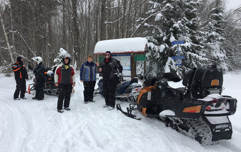
We enjoyed three days of snowmobiling in sunshine and temperatures in the minus 20's Celsius, for the most part. The second morning it was minus 44 with the wind chill, so we visited the mall and had a hot lunch at our motel prior to setting out on the trails. Pictured below are Nancy, Rick, and John.

Snowmobiling near Labrador City

Tree cover is more sparse in Labrador than we are used to in Ontario, and this means there is lots of space for trails.

Snowmobile trail near Labrador City

Typically the trails are 20 to 30 feet wide and very smooth.

Wide snowmobile trail near Labrador City

Due to the extreme cold of Labrador winters, the snowmobile clubs have built warm up huts at regular intervals along the trails. They were a welcome sight for sure. One is pictured below.

 Warm up hut on snowmobile trail near Labrador City.

The huts are outfitted inside with benches to sit on as well as a wood stove, and free wood, kindling, kerosene, and matches to start a fire. Shown below are our friends inside a cosy hut. The racks are for drying and warming up clothing around the stove.

Many local people ride without the full snowmobiling gear we are used to, and helmets are not mandatory in the province of Newfoundland and Labrador. We often saw people snowmobiling in fur trapper hats, goggles, and mittens, so I am sure their faces get really cold. Full face helmets are so much warmer and we were glad to have them.

Interior of warm up hut, near Labrador City.

This was our first trip using our new Arctic Cat snowmobile, shown below with John and I. It has two gas tanks and can travel up to 500 km between fill ups. We also found the suspension to be very comfortable, compared to our 11 year old Skidoo, and I loved having a heated seat and handlebars. Our helmet visors are also heated electrically, so they don't frost up from our breath.

John and Karen snowmobiling near Labrador City     John and Karen snowmobiling near Labrador City

From our two previous winter trips to Labrador City, we knew to stay on trails, as the un-groomed snow is very powdery, like flour or white sugar. John stepped off the trail to demonstrate this to our friends, and immediately sank up to his torso. His boot had not reached bottom yet, so he had to lay back onto the snow to roll onto the trail.

John sunk in powder snow near Labrador City

All too soon, it was time to head back to Ontario. The weather was colder on the trip out, as shown by the photos below. The first one was taken on the trip into Labrador.

View of open river from the road to Labrador City

Below is the same view four days later, silvered with frozen mist.

Open river near Labrador City

We thoroughly enjoyed our week away. If you ever get the chance, it's worth the trek to Labrador to take advantage of their world class snowmobile trails. March or April is the best time to go - good snow conditions, less cold weather, and more sunshine!

Subscribe to Karen's Newsletter if you wish to see more travel tales, studio news updates, or notices of upcoming painting classes and exhibitions.


We Found the Snow!

20 February, 2016 7 comments Leave a comment

We have had an exceptionally mild winter in central Ontario this year, with green grass on our lawn in early February, but we managed to find great snow conditions for our annual couple's snowmobile safari.

Our route took us and our friends around the eastern end of Algonquin Park, from Barry's Bay to Pembroke to Mattawa and back. The photo above is the Petawawa River.

John and Karen Richardson near Deux Rivieres     John and Karen Richardson on a Snowmobile Safari

Here are my husband and I with our Ski-Doo. During our trip, John and I celebrated our 39th anniversary, on Valentine's Day.

We saw lots of animal tracks in the snow and I managed to photograph a few of the deer we saw.

Deer near Barry's Bay

Deer near Pembroke

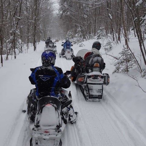
We snowmobiled for four days, hauling our gear with us and staying in a different motel or lodge each night. The trails were in excellent condition, mostly smooth and not too busy.

If you have never seen the equipment that keeps snowmobile trails in good condition, here are some photos of a groomer. It's a big tractor with a plow on the front, and tows a heavy frame behind it. In the photos the frame is raised up on wheels for road transport; once on the trail the frame will be lowered to drag along the snow surface and flatten it out.

 Snowmobile trail groomer     Snowmobile trail groomer

We drove through lovely panoramic scenery, with hillsides made silver with a hoar frost.

Hoar frost in the Ottawa Valley

The fresh snow clung to tree branches to make a 'winter wonderland'.

Near the Petawawa River

When the sun shone, the shadow-play was marvelous.

Near the Petawawa River     Creek in the Ottawa Valley

Now I have lots of ideas for paintings of winter scenes!

Stay tuned for our next snowy adventure, in the wilds of Labrador.

Subscribe to Karen's Newsletter if you wish to see more travel tales, studio news updates, or notices of upcoming painting classes and exhibitions.
Why do Butterflies Gather on Sandbanks?

07 November, 2015 5 comments Leave a comment

Last June, during our trip to British Columbia, I photographed these male Tiger Swallowtail butterflies on a sandy beach on a lake in northern Ontario. They stayed in the same spot for at least an hour, while we had a picnic lunch close by. At the time, I wondered what phenomenon kept them there in one spot for so long. Read on to the end of this article to find out the answer.

This fall, I taught a two-day watercolour workshop 'Butterflies on the Beach', using these reference photos. I began by masking off the paper margin and the butterflies with self-adhesive contact paper and drawing gum (masking fluid). Using a toothbrush, I spattered on lots of drawing gum, which forms a temporary, waterproof coating in the shape of small pebbles.

Then, using several mixtures of primary colours (Raw Sienna, Permanent Alizarin Crimson, and Indigo), I spattered on paint, sprayed on clear water, and tilted the paper to make some areas soften and run together in a cool, sandy colour. Once the paper had dried, I wiped the paint off of the plastic mask so I could take the photo below.

I peeled the plastic mask off of the butterflies and stuck the pieces onto the margin, in case I needed to re-use them. I removed all drawing gum from the sand background, to reveal white paper in the shape of small stones and large grains of sand.

Using the same primary colours mentioned above, I painted the butterflies with a pale yellow layer, let it dry, and masked out the intricate dots of light colour on the outside edges of the butterfly wings. When the masking was dry, I painted the black details over top. Then I painted in the shadows cast by pebbles and butterflies, as shown below.

To complete the painting, I removed all masking from the butterflies, added bits of blue and red dots on the wings, and bry-brushed in the details on all the little stones. Below is  the finished painting, with an integral margin. When mounted and varnished, the margin resembles a mat, such as one would use when framing with glass. The title is 'Sunbathing Swallowtails'.

Sunbathing Swallowtails (watercolour, framed size 19.5"h x 25.5"w)

Below is a detail of some of the butterflies.

Now, why do male butterflies gather at sandbanks, you ask? Apparently they are ingesting sodium and nitrates, often found in mud or damp sand. This process is commonly called 'mud-puddling', and is vital for digestion, reproduction, and flight. Who knew?

Click here for more information about the finished painting.

Subscribe to Karen's Newsletter if you wish to receive studio news updates or notice of upcoming painting classes and exhibitions.


Wildlife I Saw This Summer

20 August, 2015 2 comments Leave a comment

For five weeks this spring and summer, we drove our travel trailer from Ontario to Canada's west coast and back. Shown above is my view from the passenger side of our truck, as we towed our RV through the mountains. Below is a photo of our kit and kaboodle in British Columbia.

During our journey, we crossed paths with some interesting wildlife. Below are some quick photos I was able to capture with my trusty camera, some from the cab of our truck.


We stopped for a picnic lunch on a roadside beach on a small lake near Sault Ste. Marie, Ontario. On the sand were this group of male Tiger Swallowtail butterflies, and they fluttered around and rested in that exact spot the whole time we sat beside them. The first photo above shows them in the bottom left corner, nearest my feet.

A few miles down the road we saw this bull moose, with a new set of antlers growing. He was very wary of our truck and trailer although we were quite a distance from him. Luckily my pocket camera has a good zoom feature.

While moored on the BC coast, during an afternoon of sailing out of West Vancouver, we hiked into the forest and surprised this deer. I got two quick photos of her before she bounded away out of sight.


We stayed at a family cottage at Lake of the Woods, on our way back home from BC, and during the obligatory dump run, we saw these bald eagles and gulls waiting to scavenge the garbage. Quite often we see bears there but not this year.

Today, in our back yard in Lindsay, Ontario, we saw 17 wild turkeys. Shown here is one of the two hens who had a total of 15 chicks with them. Big families! The chicks were almost as large as the moms. The flock stayed for a few hours, eating worms brought out of the ground by a light rain shower, and leaving behind lots of fertilizer. I was able to take a few videos and lots of photos from our bedroom window.

If you would like to see more photo-articles from Karen's travels, click here to subscribe to her Studio News.

Spring Landscapes in Western Canada

21 June, 2015 1 comment Leave a comment

This spring we are on a five week adventure in our RV to the west coast of Canada and back. We left our Ontario home in late May and plan to return in early July, after journeying about 10,000 km.

We have made this trip many times, as we have family in British Columbia, Alberta, and Manitoba, but it is interesting this time to see the landscape in spring rather than summer. The photo above is the Trans Canada Highway north of Lake Superior. I love the colours: spring greens against the dark evergreens and the red rock of the region. This will make a great painting.

We are traveling 'light' this trip, with just our pickup truck and trailer, shown above. (Not our usual Traveling Roadshow of kayaks, ATV, or mountain bikes.) Our main purpose is to visit with family - spend some quality time with my Mom, (she just turned 95), see many of our nieces and nephews, and visit my husband's sister at her cottage.

Above is a scene in western Alberta, where we encountered more lovely spring greens, this time against the smoky blue of the mountains. Glacial lakes all have that unique, opaque, sea green colour, due to rock particles suspended in the water. I will paint this scene one day too.

The Crowsnest Pass is one of our favourite routes for trailering across the mountains in BC. The photo above shows how dense and healthy the forest is there.


Even in the first week of June, Osoyoos, BC is hot and hazy (above). We found out  that lots of Canadian RVers spend their winters camped here, as the climate is relatively mild, with just a few days below freezing. It's a good option for those full time RVers who can't get health insurance outside of Canada.

After visiting with my Mom for ten days, we headed up the Yellowhead Highway towards Kelowna, in the interior of BC. We saw more beautiful forests, in every shade of green.

We chose an ideal time for vacationing in British Columbia this year, as that province experienced a drought, and we have enjoyed blue skies and no rain for almost our entire trip. Forest fire smoke became noticeable in the lower mainland (greater Vancouver area) after we were homeward bound. In the photo from the Yellowhead Highway above, I think the haze is smoke, but we could not smell it in the truck.

We visited friends in Kelowna, in the Okanagan region of BC, and camped in a charming little campground in a commercial apple orchard, perched on the hills above town. The daily drive past vineyards, with Lake Okanagan in the distance, (shown above) was simply magnificent.


The cherries were almost ready for picking in the Okanagan Valley (above) in mid June.


Once you get away from Lake Okanagan, the interior of BC is very dry (above). We passed through the Shuswap region, which has scenic lakes with houseboats for rent. Some day we will go back there for a lake holiday.

Pictured above is our travel route through Rogers Pass, BC.

There was still snow in the mountain valleys in Rogers Pass, in the third week of June.

We passed this lovely river scene in western Alberta, on our way to Calgary.

I hope you have enjoyed this 'virtual spring tour' of Western Canada. If you would like to see more photo-articles from my travels, click here to subscribe to my Studio News.

Craftsman Homes on the West Coast

18 June, 2015 0 comments Leave a comment

We are leaving the Vancouver area today, after having spent ten days visiting with my Mom and other relatives. Below is a photo of me with my Mom, who just turned 95, and still has an admirable zest for life in general, and major league baseball in particular.


When we visit Mom, we like to stay at Pacific Border RV Park, a full service campground with immaculate facilities, just south of White Rock, BC. It's very quiet and just a five minute drive from my Mom's apartment. Below are some photos from their web site.


Another really desirable feature of this campground is that it borders a new housing development that contains several hundred upscale homes and condos, offering lots to see during our evening exercise walks. What especially appealed to us, is that the homes use elements of Craftsman design, something that the famous American architect, Frank Lloyd Wright, incorporated into many of his iconic Prairie style home plans.

The photo above shows a typical street in this housing development. Note the houses are similar but still unique in design and finish. They share a back lane that gives access to detached garages and parking pads.


All the homes featured front porches with interesting Craftsman style columns, quality front doors, and attractive colour schemes, such as on these models above.

We liked the stone and siding combination on the garage pictured above, as it gave us an idea what our house and garage will look like when we change the siding next summer. We will be using board-and-batten style blue vertical siding, rather than horizontal, but our stone wainscoting will look like this.

We plan to use a narrow border of river stone along the back of our house, similar to that shown above. It helps deter field mice from entering the house, and makes an attractive edging that is easy to look after when trimming grass.

It's amazing how square columns and linear trim features can give a house a sense of early 20th century Craftsman style, while still keeping an up-to-date look, and making use of modern materials that are easy to maintain.

If you would like to see more photo-articles from Karen's travels, click here to subscribe to my Studio News.

Seeing Vancouver by Boat

15 June, 2015 0 comments Leave a comment

Today was another exceptional day, spent with friends, enjoying great food and fine British Columbia sunshine. This time we cruised from a dock in Richmond (near the Vancouver Airport) up the coast to English Bay and False Creek in downtown Vancouver.


My husband John's high school chum and his wife (pictured with John, above left) took us out for the afternoon on their beautifully restored power boat. It had fore and aft double sleeping berths, two heads, a galley, an enclosed lounge area finished in vintage mahogany, a flying bridge, and an open deck at the stern. Our friends did the restoration work themselves. 

We cruised westward out of the river mouth and into the channel, then headed north towards English Bay.

We saw lots of commercial vessels, such as these tankers (above) waiting to enter Vancouver's harbour.

This is Disney's luxury cruise ship 'Wonder' departing port (above). Yes, those are Mickey Mouse ears on the funnels. Way cool.

We went under three bridges to get to the end of False Creek.

Houseboats moored in False Creek. Note the high rises of Vancouver in the background.

Artistry on grain elevators in False Creek (above).

We anchored at the end of False Creek, with this wonderful view of downtown Vancouver, BC Place Stadium, and a luxury boat marina, and enjoyed a delicious barbequed dinner. As daylight faded, we cruised back to home port in Richmond. Another fantastic day in British Columbia, thanks to our friends.

If you would like to see more photo-articles from Karen's travels, click here to join her Studio News Group.